Special Collections, Maps
50 Features of Special Collections: The American River and a Lake with Many Names
17/50
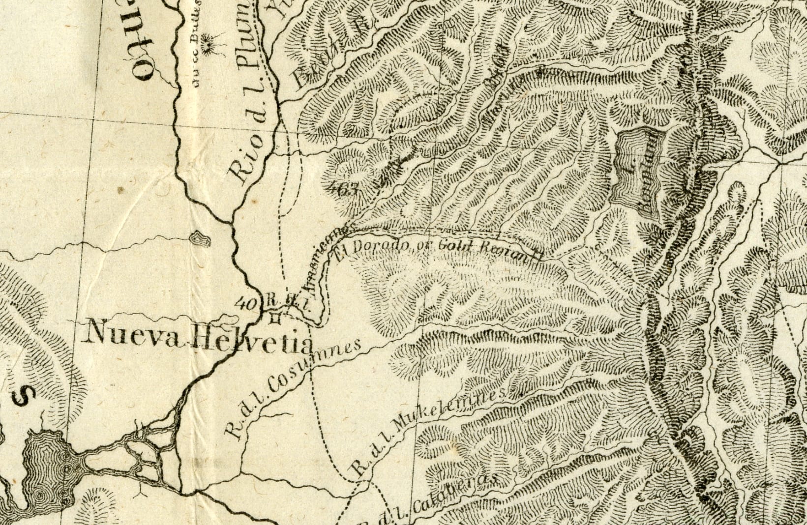
The American River does not flow directly from Lake Tahoe to the Sacramento River, but this map shows the south fork of the “Rio de los Americanos” with a direct path from what was then known as “Mountain Lake” into the “Rio Sacramento” past the town of “Nueva Helvetia”. The Spanish names reflect that California was controlled by Mexico at the time this map was created in the early 1840s. John Charles Fremont’s expedition across the western portion of North America included the region of the American River which would later become the center of the Gold Rush.
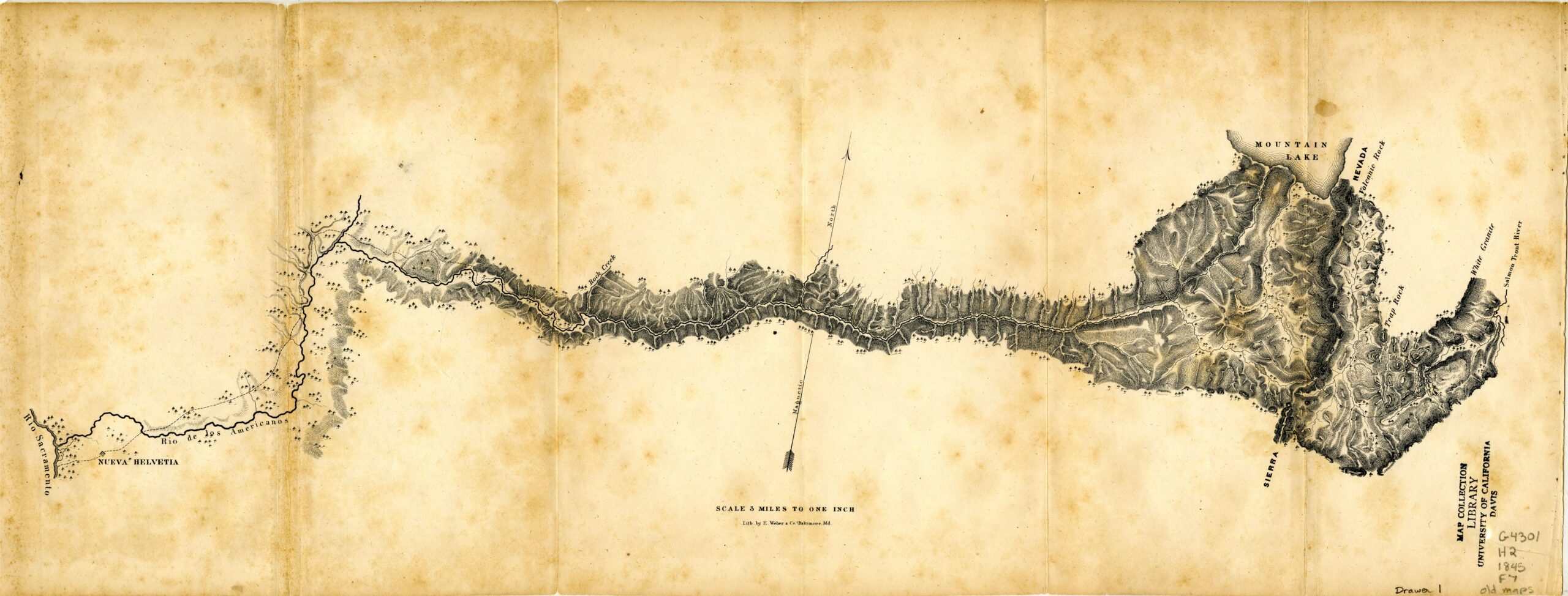
1845 Map of the American River Showing “Mountain Lake”
The naming of Lake Tahoe took many twists and turns that are reflected on early maps of California and the western states. In Fremont’s early surveys, the lake was simply named Mountain Lake. Later, Charles Preuss, a cartographer working with Fremont, drew the lake as Lake Bonpland in homage to Aimé Bonpland, a French botanist and explorer of South America.
1848 Map of the Western States Showing “L. Bonpland” [Lake Bonpland]
In 1870, the lake was officially named “Lake Bigler” in honor of John Bigler, governor of California from 1852 to 1856. However, Bigler was a strong secessionist during the Civil War, and having his name on the lake was unpopular. The official name remained on maps published by the State of California until the California Legislature formally changed it to Lake Tahoe in 1945.
![1853 Map of The United States Showing "Bigler L. [Lake]"](https://library.ucdavis.edu/wp-content/uploads/2022/02/Bigler_Original.jpg)
1853 Map of The United States Showing “Bigler L.” [Bigler Lake]
Here we have an 1849 map that is unique in referring to the lake as “Fremonts L.” [Fremont’s Lake].
![1849 Map of the Gold Regions of California showing "Fremonts L." [Fremont's Lake]](https://library.ucdavis.edu/wp-content/uploads/2022/02/Fremonts-Lake.jpg)
1849 Map of the Gold Regions of California showing “Fremonts L.” [Fremont’s Lake]
This 1884 map of Central California is particularly interesting in that shows Lake Bigler and Lake Tahoe as being interchangeable names referring to the same body of water.
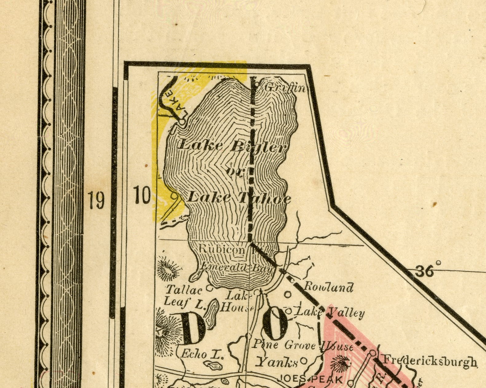
1884 Map Showing “Lake Bigler or Lake Tahoe”
And finally we see the name Lake Tahoe returning to its Washo Native American beginnings meaning “big water” in this 1900 map issued by the California-Paris Exposition Commission of 1900.
Map of California issued by the California-Paris Exposition Commission of 1900
Information for this blog post comes from the gazetteer California Place Names; the Origin and Etymology of Current Geographical Names. A gazetteer is a geographical dictionary, and a collection of gazetteers in the Map Collection room help begin research for place names.
You can view these maps in the Map Collection room on the Lower Level of Shields Library, 1:00-5:00 p.m., Monday through Friday.
Sources:
Gudde, Erwin Gustav. California Place Names; the Origin and Etymology of Current Geographical Names. Rev. and Enl. 3d Ed., with Maps and Reference List of Obsolete Names. Berkeley: University of California Press, 1969. Print.
Map showing “Mountain Lake”:
Frémont, John Charles, Edward Weber & Co, and United States. Congress. Senate. [Course of the American River from Lake Tahoe to Nueva Helvetia]. Washington, D.C.: Gales and Seaton, 1845. Print.
Shields Library Map Collection Old Maps (MAP G4301.H2 1845 .F7 Drawer 1 )
Map showing “L. Bonpland” [Lake Bonpland]:
Frémont, John Charles, Charles Preuss, and Edward Weber & Co. Map of Oregon and Upper California, from the Surveys of John Charles Frémont and Other Authorities. Washington, D.C.: Senate, 1848. Print.
Shields Library Map Collection Old Maps (MAP G4210 1848 .P7 )
Map showing “Fremonts L.” [Fremonts Lake]:
Wyld, James. Map of the Gold Regions of California. London: s.n., 1849. Print.
Shields Library Map Collection (MAP G4300 1849 .W9 ) – reproduction.
Map showing “Lake Bigler”:
Goddard, George H., and Britton & Rey. Britton & Rey’s Map of the State of California. Berkeley, Calif.: Friends of the Bancroft Library, 1969. Print.
Shields Library Map Collection (MAP G4360 1857 .G6 ) – reproduction.
Map showing “Lake Bigler or Lake Tahoe”
Rand McNally Company. [Rand McNally Map of California]. Chicago, IL, 1884. Print.
Map of California issued by the California-Paris Exposition Commission of 1900
H.S. Crocker & Co, and California-Paris Exposition Commission of 1900. Map of California / Copyrighted by H.S. Crocker Co. San Francisco: California-Paris Exposition Commission of 1900, 1900. Print.
Post created by Dawn Collings & Kristoffer Landes