Special Collections Featured Images
50 Features of Special Collections: A Rescued Map – California 1852
10/50
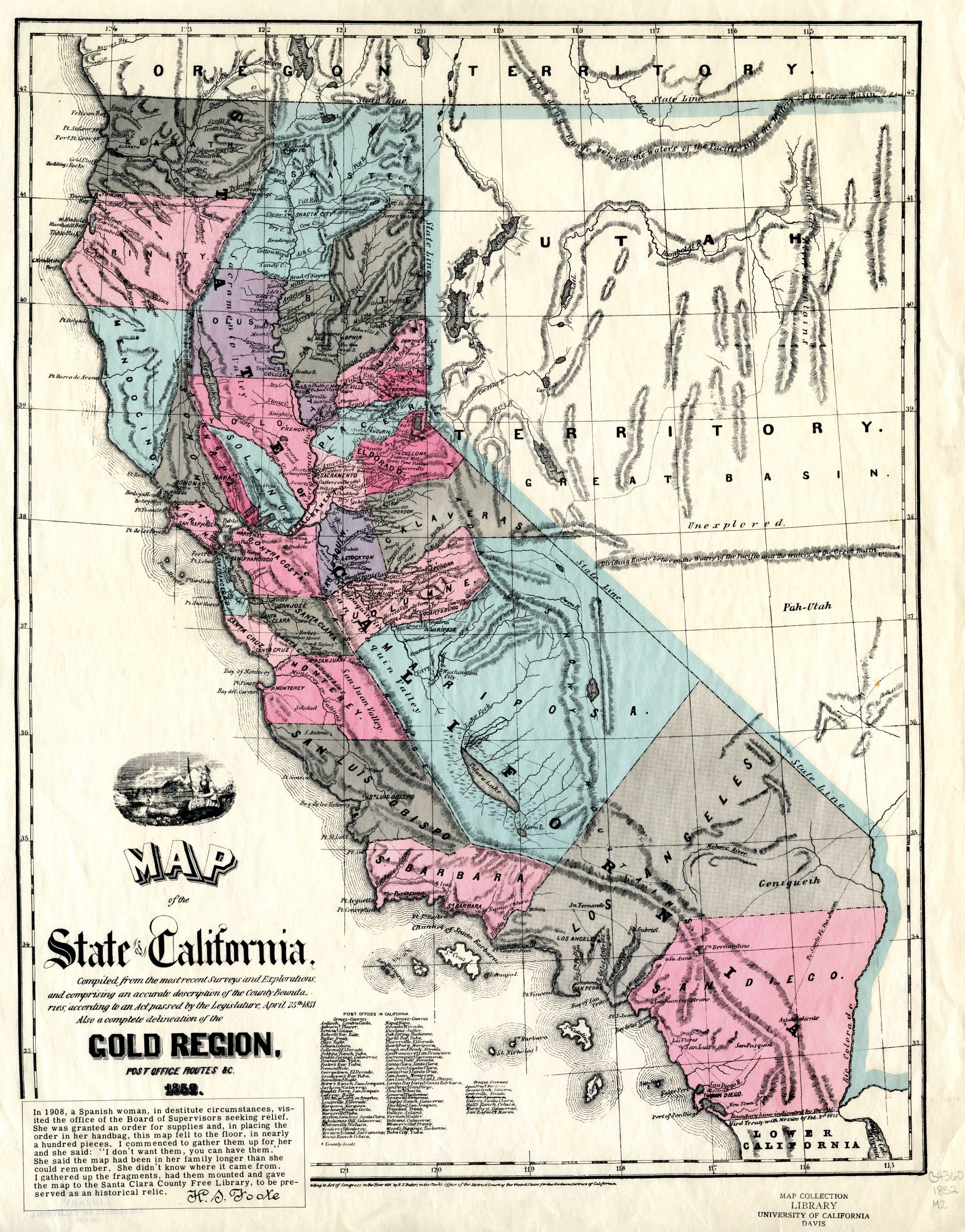
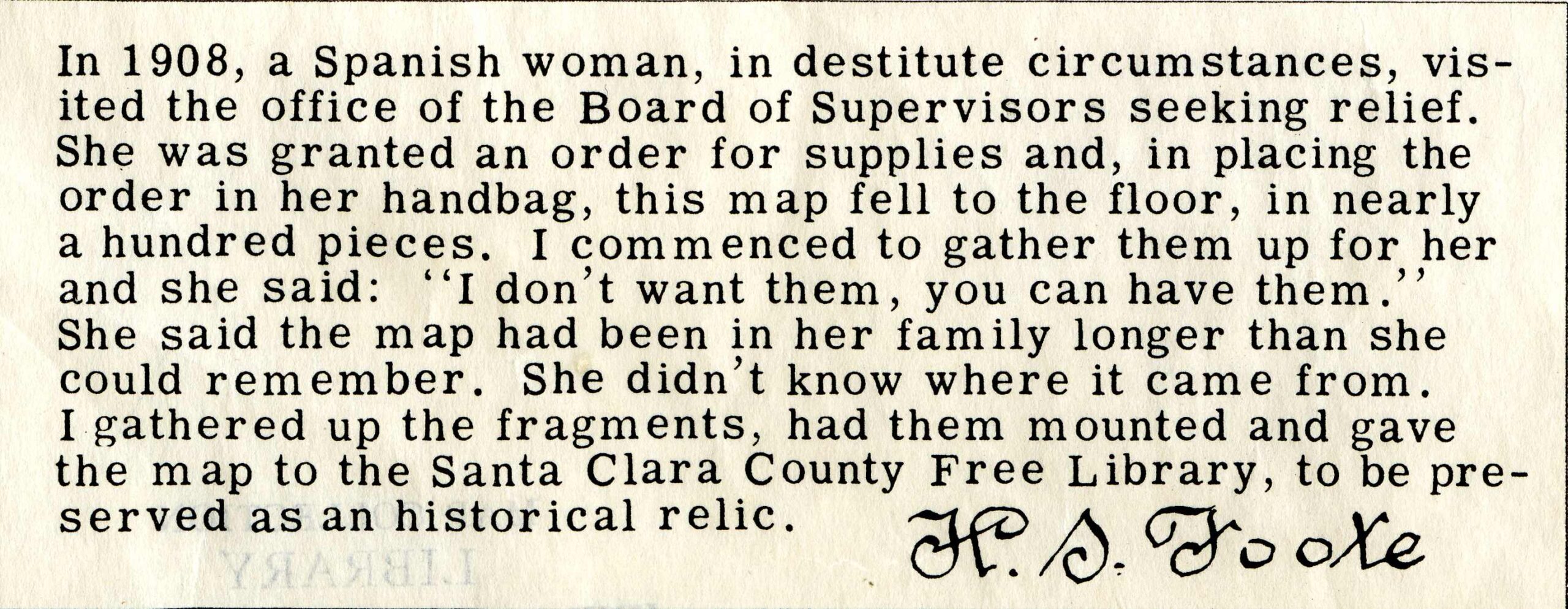
This colorful map depicts counties in the state of California as of 1852 and is unique in that its path to preservation involved piecing it together from scraps after it fell out of a woman’s handbag.
The California Legislature enhanced the map showing county boundaries, a list of post offices, and postal routes.
One of the most eye-catching features of this map is the configuration of county boundaries in 1852. Throughout the history of California, the counties have changed, developed, been renamed, and divided into multiple counties into today’s current configuration.
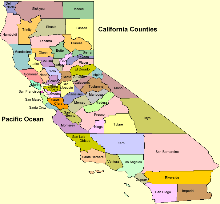
Current California County Boundaries
The story in the lower left corner of the map tells how H. S. Foote rescued this map in 1908 and gave it to the Santa Clara County Free Library for preservation.
Explanatory Paragraph
The quotation in the lower margin (which is partially obscured by Foote’s notes) reads, “Entered according to act of Congress in the year 1851 by B.F. Butler in the clerk’s office of the district court of the United States for the northern district of California.”
You can view this map–and other early California maps–in the Map Collection room on the Lower Level of Shields Library, 1:00-5:00 p.m., Monday through Friday. Map Call Number: MAP G4360 1852 .M2
Post created by Dawn Collings, Kristoffer Landes, and Louis Cashatt.