Special Collections, Maps
50 Features of Special Collections: Miller & Lux Maps
Henry Miller and Charles Lux created the Miller and Lux Corporation which was headquartered in Los Banos, California. Individually, and together as a corporation, they were instrumental in developing much of the cattle and farming businesses in much of the San Joaquin Valley in the late 1800s and early 1900s.
The Special Collections Department at UC Davis is home to the Miller & Lux Records which houses contracts, inventories, patents and leases related to the Miller & Lux ranching partnership. The call number for this collection is D-094.
After Henry Miller died in 1916, the corporation did not survive very long, and the families started selling much of the properties. The Map Collection holds maps featuring Miller & Lux properties which were for sale.
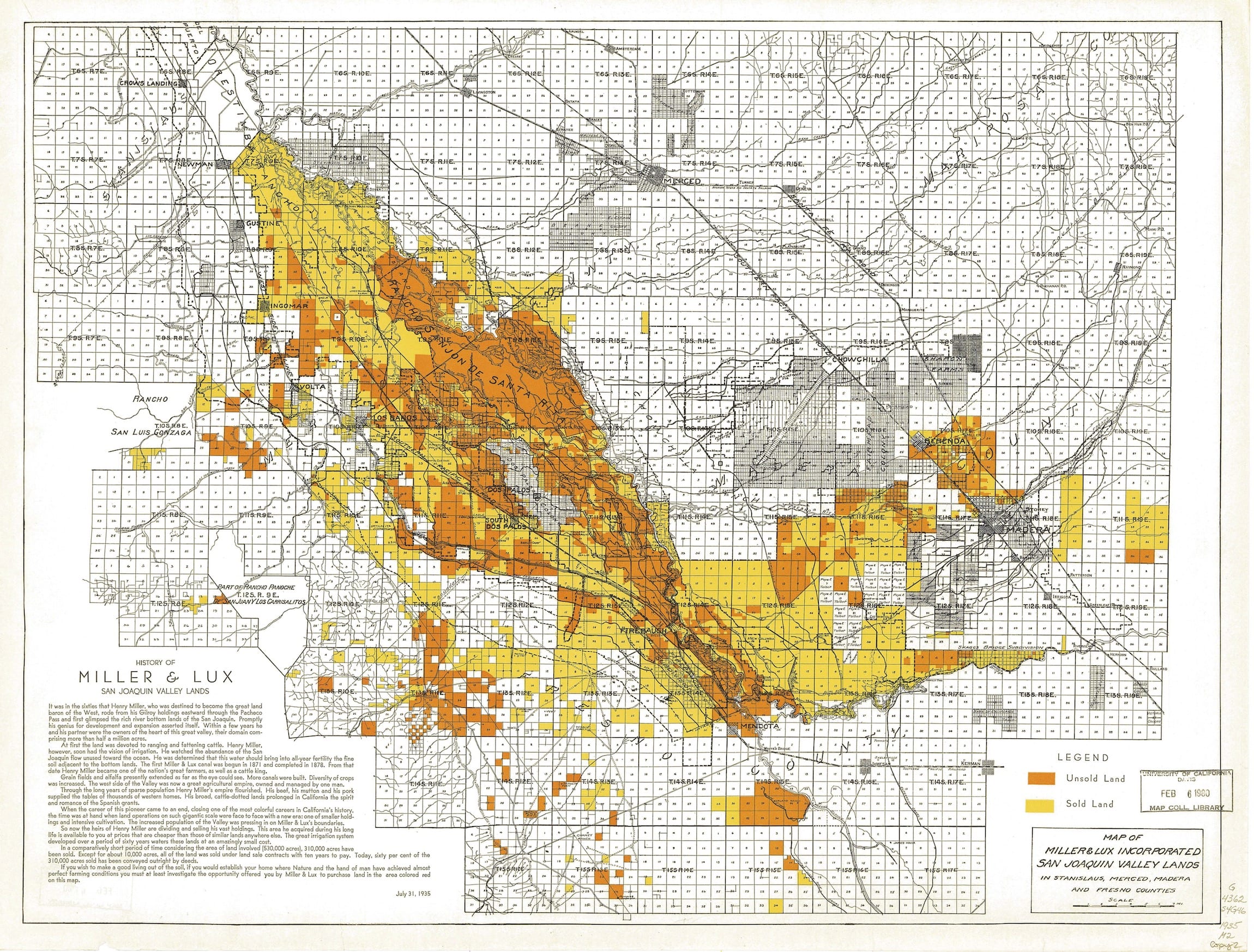
Miller & Lux. Map of Miller & Lux Incorporated San Joaquin Valley Lands : In Stanislaus, Merced, Madera and Fresno Counties [Calif.]. San Francisco: Miller & Lux, Inc., 1935. Call Number: MAP G4362.S4G46 1935 M2
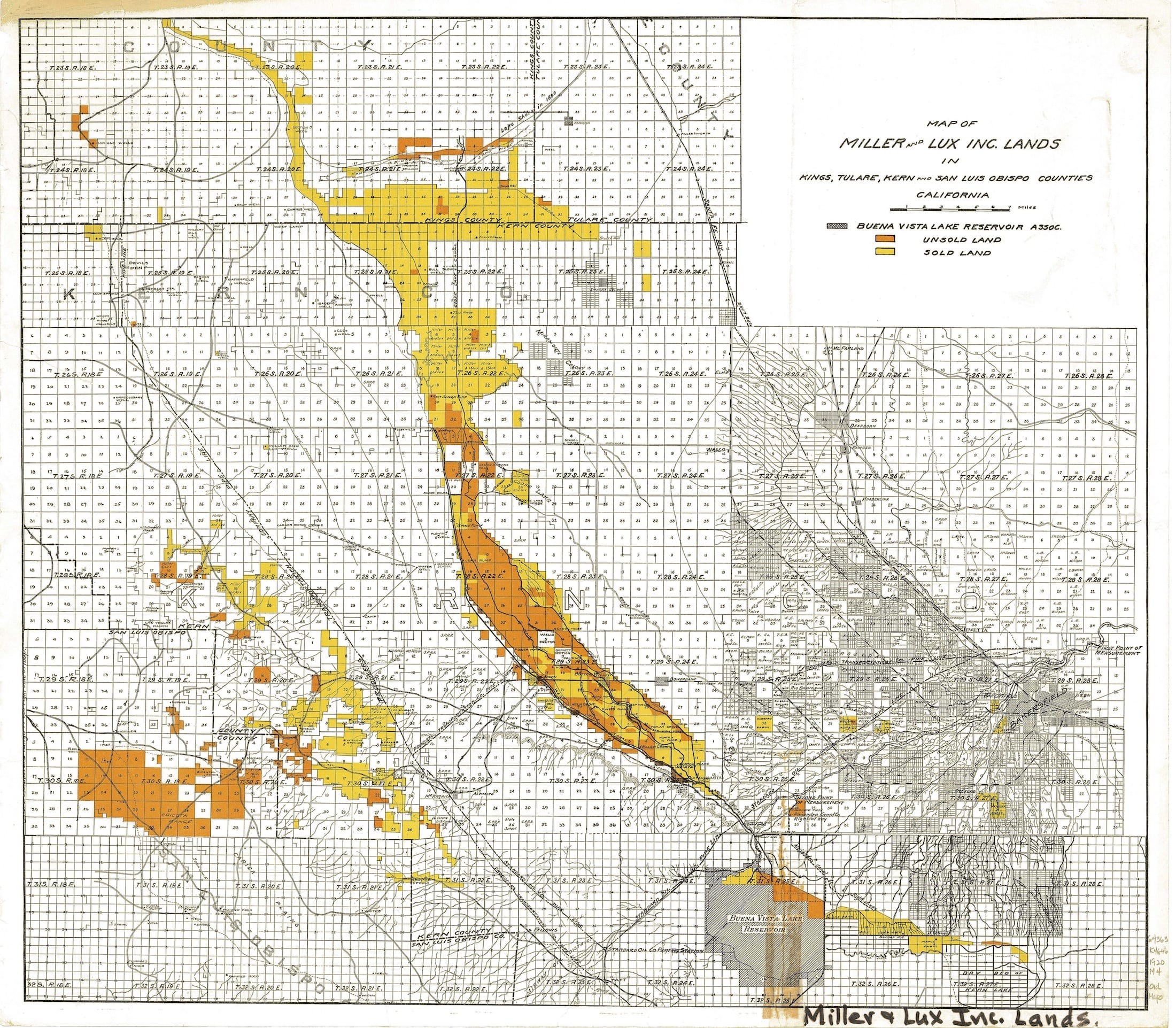
Miller & Lux. Map of Miller and Lux Inc. Lands in Kings, Tulare, Kern and San Luis Obispo Counties, California. San Francisco, CA: Miller & Lux, 1920. Call Number: MAP G4363.K4G46 1920 M4
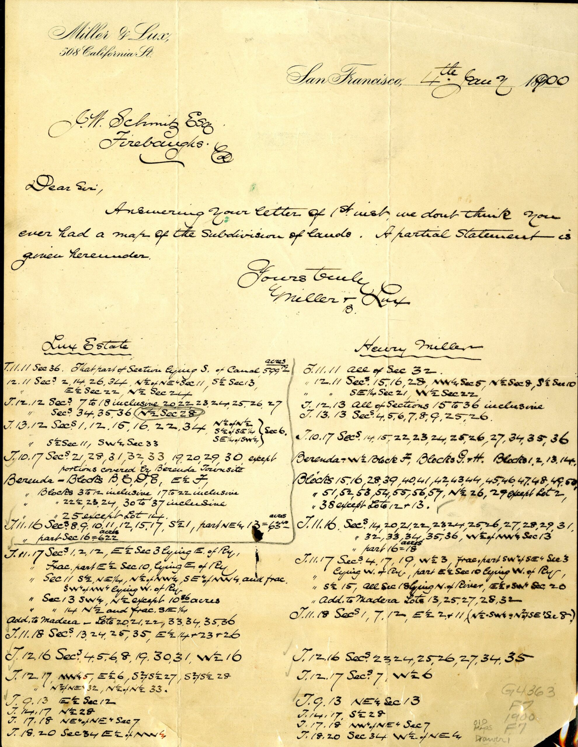
[Fresno County, California, western portion]. San Francisco, CA : s.n., 1900. Call Number: MAP G4363.F7 1900 F7
Here are some citations for additional maps in the Map Collection room:
Map of Miller and Lux Inc. lands in Kings, Tulare, Kern and San Luis Obispo counties, California. San Francisco: Miller & Lux, 1930. Call Number: MAP G4362.S4G46 1930 .M2
Miller & Lux. Map of Miller & Lux Incorporated San Joaquin Valley Lands : In Stanislaus, Merced, Madera and Fresno Counties [Calif.]. San Francisco: Miller & Lux, Inc., 1935. Call Number: MAP G4362.S4G46 1935 M21
San Lorenzo or Peach Tree Ro. S.l.: Miller-Lux Land Co.?, 19–?. Call Number: MAP G4363.M8G465 1900 S3
Map of the Rancho San Lorenzo and Peach Tree Possessions, Property of Miller and Lux. S.l.]: Miller and Lux, 1912. Call Number: MAP G4363.M8G465 1912 M2
Map of the Rancho San Lorenzo and Peach Tree Possessions, Property of Miller and Lux. S.l.]: Miller and Lux, 19–?. Call Number: MAP G4363.M8G465 1900 .M21
Map of the Rancho San Lorenzo and Peach Tree Possessions, Property of Miller and Lux. S.l.]: Miller and Lux, 19–?. Call Number: MAP G4363.M8G465 1900 .M3
Post created by Dawn Collings and Kristoffer Landes.