Meet Library Intern Holden Tal
In fall 2025, the library launched a paid internship program for undergraduates to gain professional experience while supporting library services. There are four undergraduate students in our inaugural 2025-26 cohort, and today we’re pleased to share an update from intern Holden Tal.
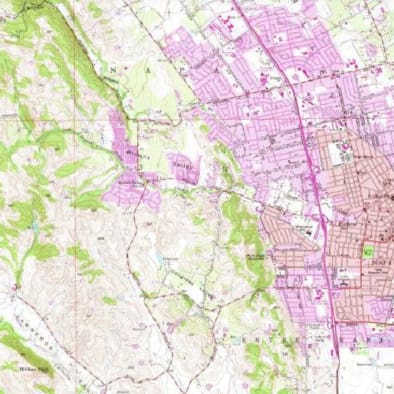
As the geospatial intern for the UC Davis DataLab, Holden is working on projects that analyze and visualize data through maps.
Check back soon to hear from our fourth intern, Anette Dabkowski, and catch up on our other interns and their projects.
Interview with Holden Tal
Team: DataLab
Project: American Viticultural Areas (AVA) Digitizing Project
What are you working on?
Once I completed training in version control and QGIS software tools, I was put on the American Viticulture Areas (AVA) Digitizing Project, which the DataLab spatial team has been a part of since its inception in 2017. The goal of this project is to create a database of digitized maps of legal wine-growing regions in the United States. The AVA petitions contain descriptions of what unique features warrant the designation of the AVA, along with boundary descriptions.
At the start of the project, only narrative descriptions of the legal boundaries existed; there was no cartographic representation. This project fills that gap.
What has your internship experience been like?
The entire team at DataLab has been welcoming, and I feel very supported by my supervisor. Being new to the field of geospatial data, most questions that I have are rudimentary, but they are always encouraged and answered thoughtfully.
In the AVA project, tasks are book-ended by submitting “pull requests” via Github (proposals to merge code changes into a project). When I come to the close of a task and I submit a pull request, I feel a mix of pride and healthy uncertainty. I reflect on how at the beginning of the internship I had no experience with version control and it feels good to take stock of the progress I have made. There is still a part of me that is unsure if I have completed the task correctly — fortunately, there is a quality control step where my work will be checked.
What’s next?
I look forward to furthering my knowledge in GIS and applying these skills to research of my own.