Skip to main content My Account Off-Campus Access Give Meet with a Librarian Directory Library Services Technical Support Submit a Digital Sign Give Newsletters Social Media

The Ground Beneath Our Feet: The Nikola P. Prokopovich Papers on Land Subsidence

Exhibit Details

Dr. Nikola P. Prokopovich (1918-1999) was born in Kiev, Ukraine and came to the United States in 1950. He made his home in Sacramento, where he worked as a geologist with the Bureau of Reclamation’s Mid-Pacific Region. Dr. Prokopovich worked out of the Sacramento office from 1958-1986, investigating the geology and geochemistry of California statewide water projects, including the Central Valley Project and the Solano Project. Because of the wide-ranging impact of the Central Valley Project, the Prokopovich papers will be of interest to a number of disciplines: geology; environmental science and policy; water science; soil science; and history, especially history of agriculture.
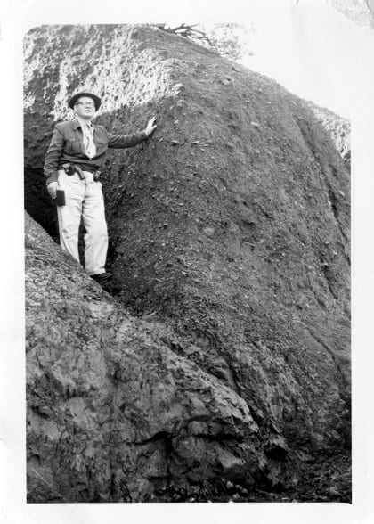
Prokopovich stands at the base of a massive rounded rock formation in a rocky wash, one hand resting on the rock face.

Nikola Prokopovich in a tributary wash, ca. 1950
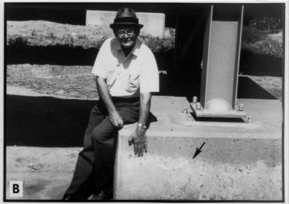

Prokopovich sits on a concrete ledge beside aqueduct infrastructure; a downward arrow marks where ground level has dropped.

Prokopovich at East Bay Aqueduct showing change in ground level, ca. 1960
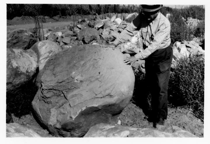

Prokopovich stands beside a large rounded sandstone boulder, both hands on its surface; rubble and broken rock pile behind him.

Nikola Prokopovich with sandstone boulder, ca. 1960


Prokopovich was an avid field geologist and spent as much time as possible on-site, collecting his own data. He was particularly interested in the engineering geology of the Central Valley Project’s canals and dam sites and in the effects of both the state water projects and field irrigation on the surrounding landscape. The collection includes draft reports, memoranda, and published writings, as well as nearly 25,000 slides and photographs documenting his work and the land around his work sites.
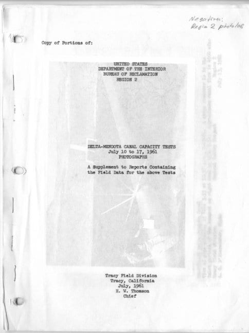
Cover page of a 1961 Bureau of Reclamation report, noting Delta-Mendota Canal capacity tests, with a handwritten archival note.
1961 Bureau of Reclamation report cover
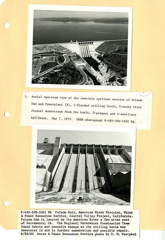
Notebook page with two mounted photographs of Folsom Dam — an aerial view and a close-up of the spillway — captioned with technical details from a 1975 USBR inspection.
Photos of Folsom Dam from Prokopovich’s notebooks
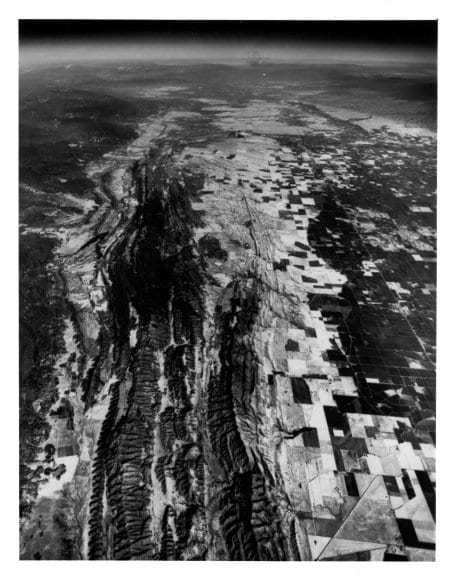
Aerial view of the Sacramento Valley: a rugged mountain ridgeline runs alongside a vast flat plain of grid-pattern agricultural fields.

Sacramento Valley from the air


The Central Valley Project

The Central Valley Project (CVP) is a Bureau of Reclamation federal water project designed to provide irrigation and municipal water to California’s Central Valley. Reservoirs in the northern half of the state regulate and store water and a series of canals, aqueducts, and pump plants transport it to the San Joaquin Valley and its surroundings.

Source: Central Valley Project, Wikipedia
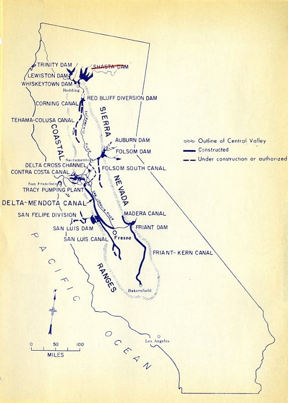
Map of California showing Central Valley Project infrastructure: dams (Shasta, Folsom, San Luis, Friant), major canals, and aqueducts running from the Sacramento Valley south to Bakersfield. Legend distinguishes constructed from authorized features.
Map of the Central Valley Project
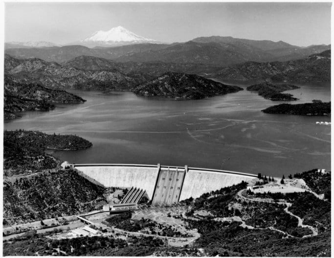
Aerial view of Shasta Dam, a large concrete arch dam, with Shasta Lake stretching behind it and snow-capped Mount Shasta visible in the distance.
Shasta Dam Courtesy of the US Bureau of Reclamation
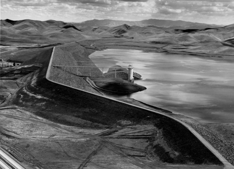
Aerial view of San Luis Dam, an earth-fill dam, with its reservoir and an intake tower visible; rolling hills extend to the horizon.
San Luis Dam and Reservoir Courtesy of the US Bureau of Reclamation
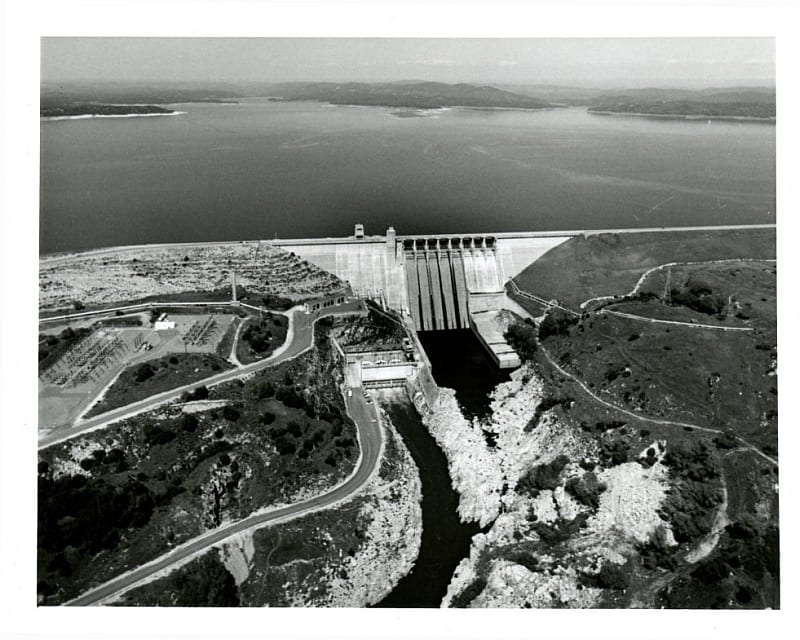
Aerial view of Folsom Dam showing the dam face, powerhouse, and downstream channel, with Folsom Lake reservoir stretching behind.
Folsom Dam, courtesy of the US Bureau of Reclamation
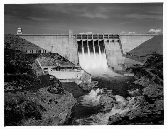
Ground-level view of Folsom Dam with water discharging through multiple open spillway gates into the rocky river channel below.
Folsom Dam, courtesy of the US Bureau of Reclamation
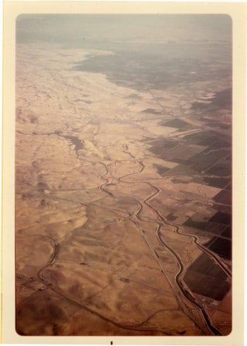
Aerial view of the San Joaquin Valley: a winding river cuts through arid flatlands with agricultural fields stretching into the haze.
Nikola P. Prokopovich Papers: San Joaquin Valley from the air

Subsidence

Land subsidence occurs when large amounts of ground water have been withdrawn from certain types of rocks, such as fine-grained sediments. The rock compacts because the water is partly responsible for holding the ground up. When the water is withdrawn, the rock falls in on itself.

Source: The USGS Water Science School
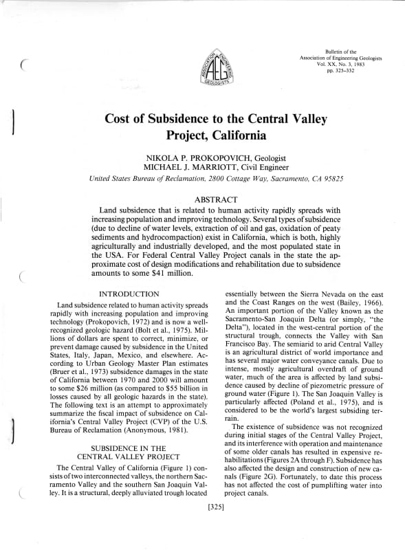
First page of a 1983 journal article by Prokopovich and Marriott in the AEG Bulletin, including abstract and introduction discussing subsidence costs to California's Central Valley Project.
Cost of Subsidence to the Central Valley Project, CA by Prokopovich, N.P., and Marriott, M.J., 1983
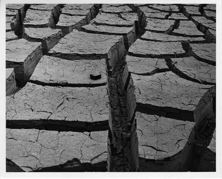
Close-up of severely cracked dried mud forming deep polygonal blocks; a small object at center provides scale.
Shrinkage cracking in mud
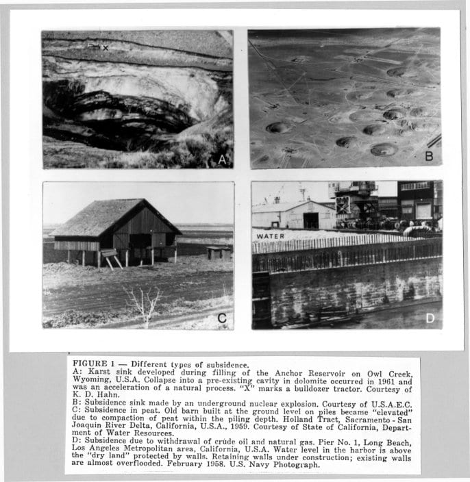
Four labeled photographs (A–D) showing subsidence types: a karst sinkhole, aerial craters from nuclear subsidence, a barn elevated by peat compaction, and a harbor wall overtaken by rising water.
Four examples of subsidence
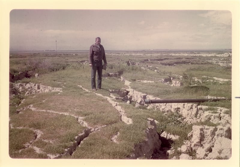
A man stands on cracked, slumped soil; a pipe lies exposed in a deep fissure running across the foreground.
Soil cracking and slumpage, ca.1970
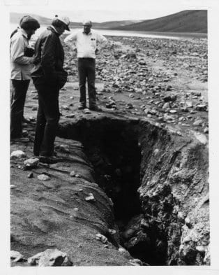
Three people stand at the edge of a large open fissure in rocky ground, looking down into the crack.
Open crack at Clear Lake, ca. 1965

Subsidence in Delta Peat

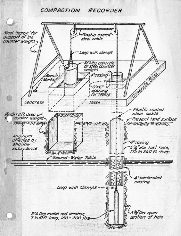
Labeled technical diagram of a compaction recorder showing the above-ground frame with counterweight and the below-ground casing, anchor rod, and perforated pipe extending 175–240 feet deep.
Schematics for a compaction recorder
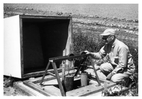
A researcher crouches beside a compaction recorder in an open field, adjusting the instrument mounted on a low wooden frame.
Compaction recorder in use, ca. 1965
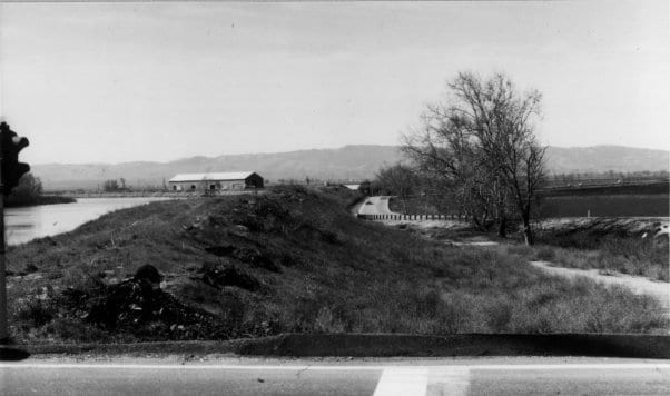
A levee runs through flat agricultural land; water sits visibly higher on the left side, illustrating ground subsidence on the right.
Subsidence at Byron Tract. Note the difference in ground level on the left and right sides of the levee.
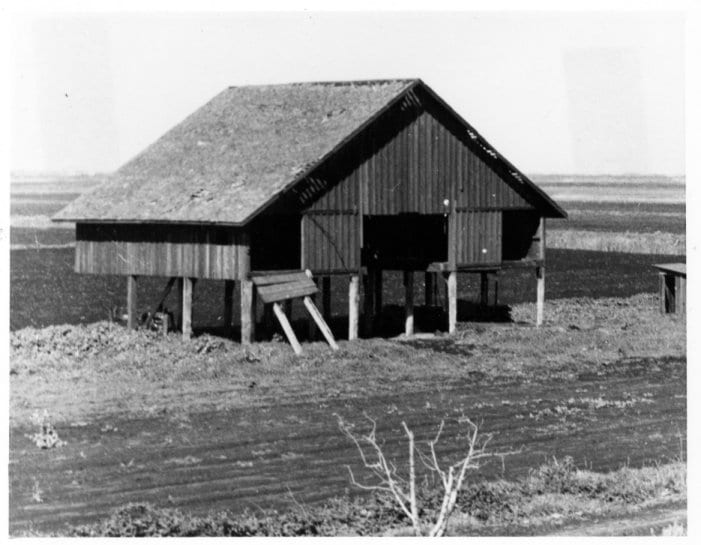
A wooden barn stands elevated on tall exposed pilings above flat delta farmland, the surrounding ground having subsided beneath it.
Holland Tract, near Sacramento. This barn was originally built level to the ground. Courtesy of the State of California Department of Water Resources
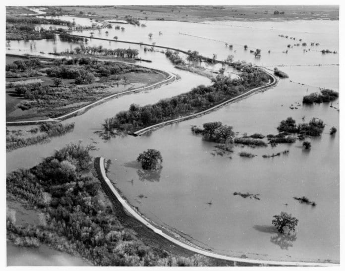
Aerial view of Sherman Island during flooding; levee roads curve through a landscape almost entirely submerged, with treetops barely visible above the water.
Sherman Island floodwaters, ca. 1980 Courtesy of the US Army Corps of Engineers

Hydrocompaction

Hydrocompaction is the settling and hardening of land due to application of large amounts of water for irrigation.

Source: EPA Climate Change Glossary
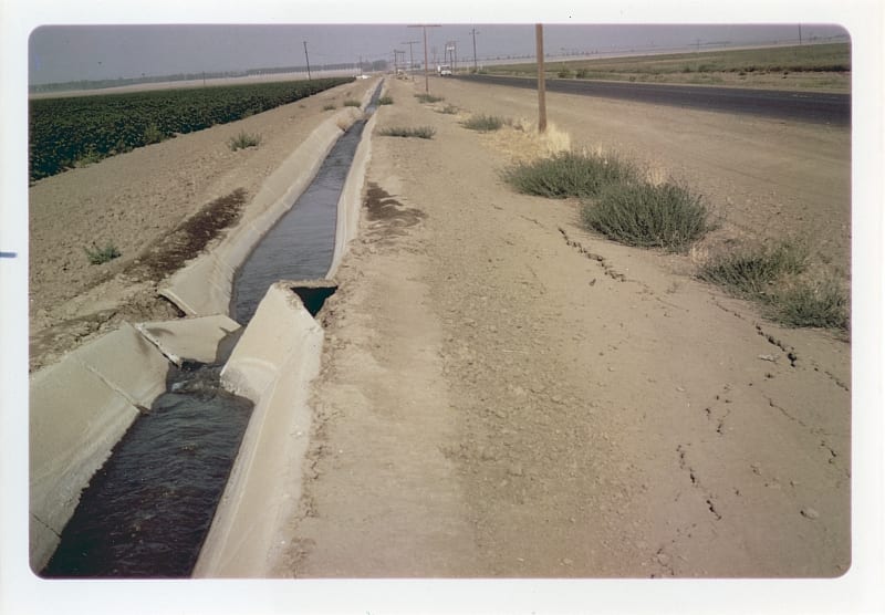
A concrete-lined irrigation ditch runs alongside a road through flat farmland; a section of lining has cracked and collapsed inward.
Damage to irrigation ditch due to hydrocompaction
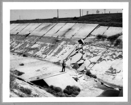
A man stands amid large broken concrete slabs on the floor of a drained canal; the canal lining has buckled and collapsed along the slope above him.
Damage to Mendota Test Canal lining due to hydrocompaction, ca. 1965
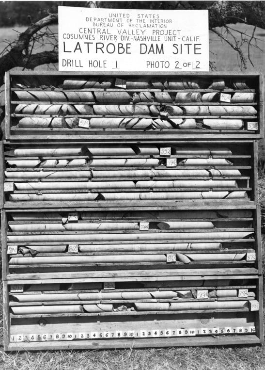
Rows of cylindrical drill core samples in labeled trays from Latrobe Dam Site, Drill Hole 1 — a Bureau of Reclamation Central Valley Project soil investigation.
Core samples from Latrobe Dam site. Understanding the properties of the surrounding soil is crucial for dam safety.
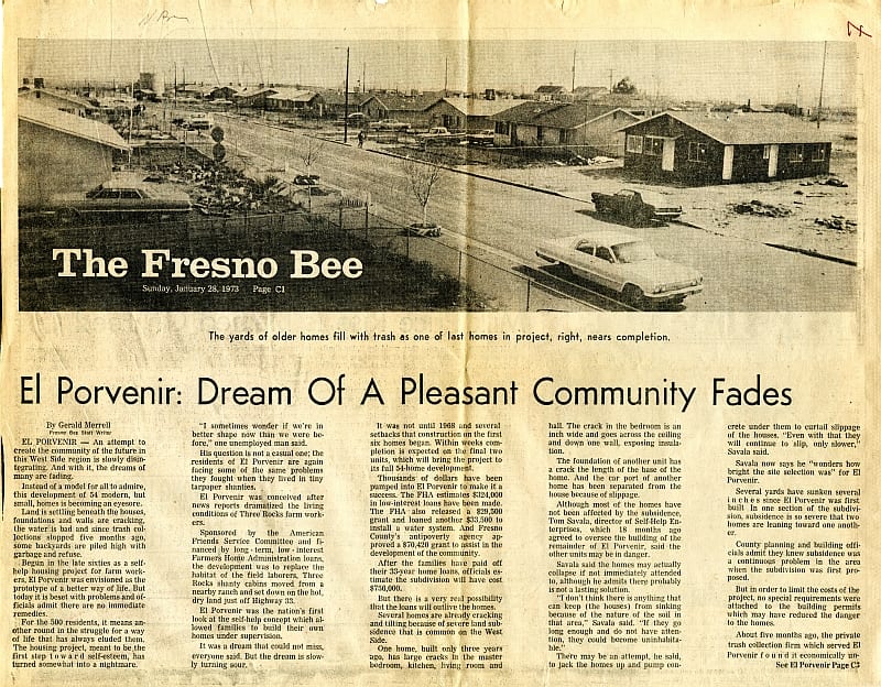
Front page of the Fresno Bee, with headline "El Porvenir: Dream of a Pleasant Community Fades" and a photograph of the housing development.
Fresno Bee, January 28, 1973. Page C1.

“Several homes are already cracking and tilting because of severe land subsidence…One home, built only three years ago, has large cracks in the master bedroom, kitchen, living room, and hall. The crack in the bedroom is an inch wide and goes across the ceiling and down one wall, exposing insulation.”
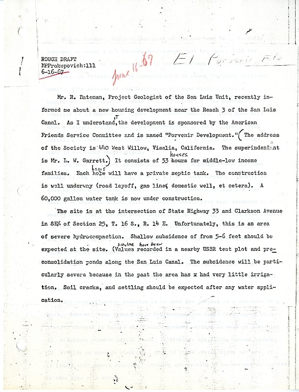
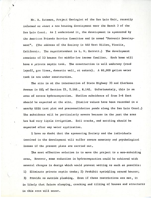
Rough draft of a 1967 Prokopovich memorandum warning that a new housing development near the San Luis Canal sits in a severe hydrocompaction zone; handwritten edits visible throughout.
Prokopovich memorandum on El Porvenir housing development, June 1967 — rough draft, page 1
Second page of the 1967 Prokopovich memorandum, recommending the project relocate or eliminate irrigation features to reduce hydrocompaction risk.
Prokopovich memorandum on El Porvenir housing development, June 1967 — page 2

“Shallow subsidence of from 5-6 feet should be expected at the site… The subsidence will be particularly severe because in the past the area has had very little irrigation.”

Memorandum from Prokopovich’s files, 1967 (pg.1)

Monitoring the Environment
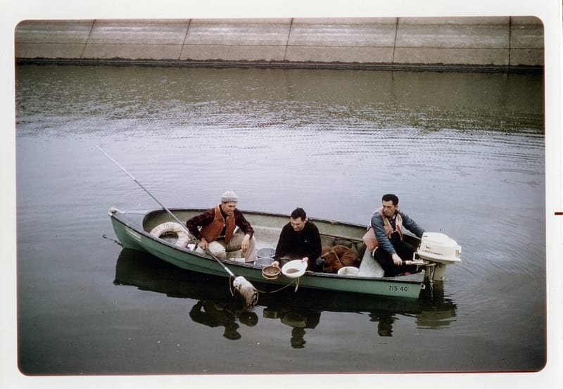
Three researchers in a small motorboat on a canal, collecting water or organism samples alongside a concrete-lined bank.
Canal sampling in the Delta-Mendota Canal

Canal sampling is done to gauge ecosystem health and to measure organisms’ impact on canal capacity.
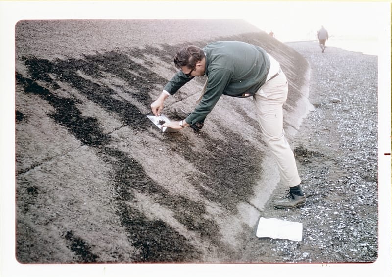
A researcher leans over the exposed bed of a drained canal, collecting sediment or organism samples onto a sheet of paper; a second person walks the bank behind.
Post-dewatering sampling in Delta-Mendota Canal, ca. 1970
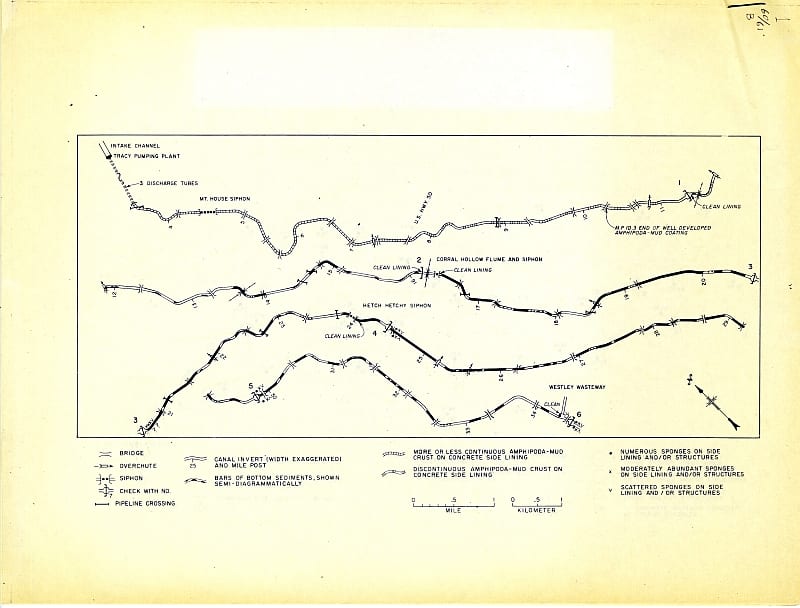
Map of the Delta-Mendota Canal from Tracy Pumping Plant showing distribution of amphipod-mud crusts, sponges, and bottom sediments across six canal reaches, with legend.
Delta-Mendota Canal ecological sampling data
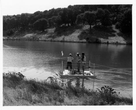
Three researchers stand on a small floating platform in Lake Solano, conducting water sampling with equipment; a wooded hillside rises behind them.

Copper sampling in Lake Solano. These studies investigated the aftereffects of mining: what residues are in our water?
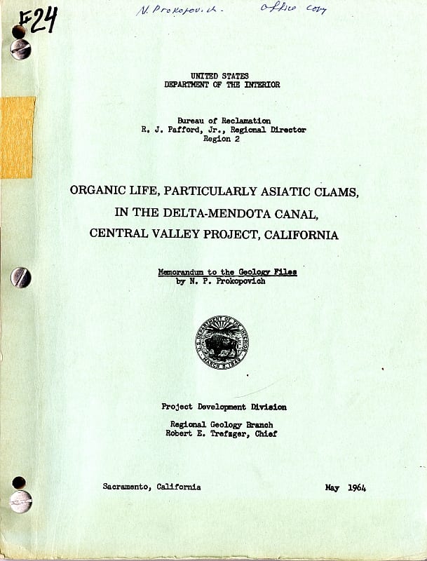
Cover of a May 1964 Bureau of Reclamation memorandum by Prokopovich on organic life in the Delta-Mendota Canal; annotated "office copy" in Prokopovich's hand.
Organic Life, Particularly Asiatic Clams, in the Delta Mendota Canal, Central Valley Project, California
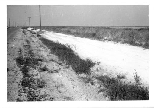
A thick white salt crust coats the ground alongside a dirt road and drainage ditch running through flat, open farmland.

Salt crust in irrigation ditch.

Salt deposits are left by chemical fertilizers and by the salts naturally present in water. These deposits have a major effect on the water supply downstream.

Processing of the Nikola P. Prokopovich Papers was generously funded by the Andrew W. Mellon Foundation, and administered by the Council on Library and Information Resources (CLIR). The University of California, Davis Special Collections was awarded a Cataloging Hidden Special Collections and Archives grant from 2010-2012, “Uncovering California’s Environmental Collections,” in collaboration with eight additional special collections and archival repositories throughout the state and the California Digital Library (CDL). Grant objectives included processing of over 33 hidden collections related to the state’s environment and environmental history. The collections document an array of important sub-topics such as irrigation, mining, forestry, agriculture, industry, land use, activism, and research. Together they form a multifaceted picture of the natural world and the way it was probed, altered, exploited and protected in California over the twentieth century. Finding aids are made available through the Online Archive of California.


Images (unless otherwise credited) are the property of the Regents of the University of California; no part may be reproduced or used without permission of the Department of Special Collections.